


Click the photo to view the full-size version
| Name | Soo Line Trail US-10 Bridge Minnesota Highway Department Bridge #9174 |
| Built By | Minneapolis, St. Paul & Sault Ste. Marie Railroad |
| Currently Owned By | Morrison County Regional Rail Authority |
| Superstructure Contractor | Unknown |
| Substructure Contractor | Unknown |
| Length | 330 Feet Total, 70 Foot Largest Span |
| Width | 1 Track |
| Height Above Ground | 25 Feet (Estimated) |
| Superstructure Type | Through plate girder and deck plate girder |
| Substructure Type | Concrete |
| Date Built | 1958, likely using secondhand parts |
| Original Location(s) | Unknown |
| Traffic Count | 0 Trains/Day (Bridge is a Trail) |
| Current Status | Open to trail traffic |
| Significance | Local Significance |
| Documentation Date | 1/10/2022 |
In 1907, the Minneapolis, St. Paul & Sault Ste. Marie Railway (Soo Line) began construction on a new railroad line, extending from the existing mainline at Brooten, Minnesota; to the Twin Ports city of Duluth, Minnesota. The first 87 miles were completed by the end of 1908, with the remaining 100 miles completed in 1909. The Soo Line was a smaller railroad in the Midwest, with routes extending through Minnesota, Wisconsin, Michigan and North Dakota. It was operated as a subsidiary of Canadian Pacific Railway (CP). This route became a critical connection for the Soo Line, providing a connection between the existing mainline at Brooten and the industries at Duluth. By 1937, the Soo Line had entered bankruptcy, and it would be reorganized as the Minneapolis, St. Paul & Sault Ste. Marie Railroad in 1944.
By 1961, the Soo Line would be merged with other CP subsidiaries Duluth, South Shore & Atlantic Railroad and Wisconsin Central Railroad to form Soo Line Railroad, a company controlled by CP. In 1984, the Soo Line would be reorganized as the Soo Line Corporation, and the railroad would be fully merged into CP in 1990. The segment from Genola to Superior was abandoned in 1990. The segment from Genola to Boyleston was purchased by MNDOT and Douglas County, Wisconsin and converted to the Soo Line Trail. The remainder of the route would be abandoned in 1996, and purchased by Morrison and Stearns Counties for trail use. Today, much of the route has been converted to the Soo Line Trail, and further work is being done in Stearns County to convert the railroad to the Dairyland Trail.
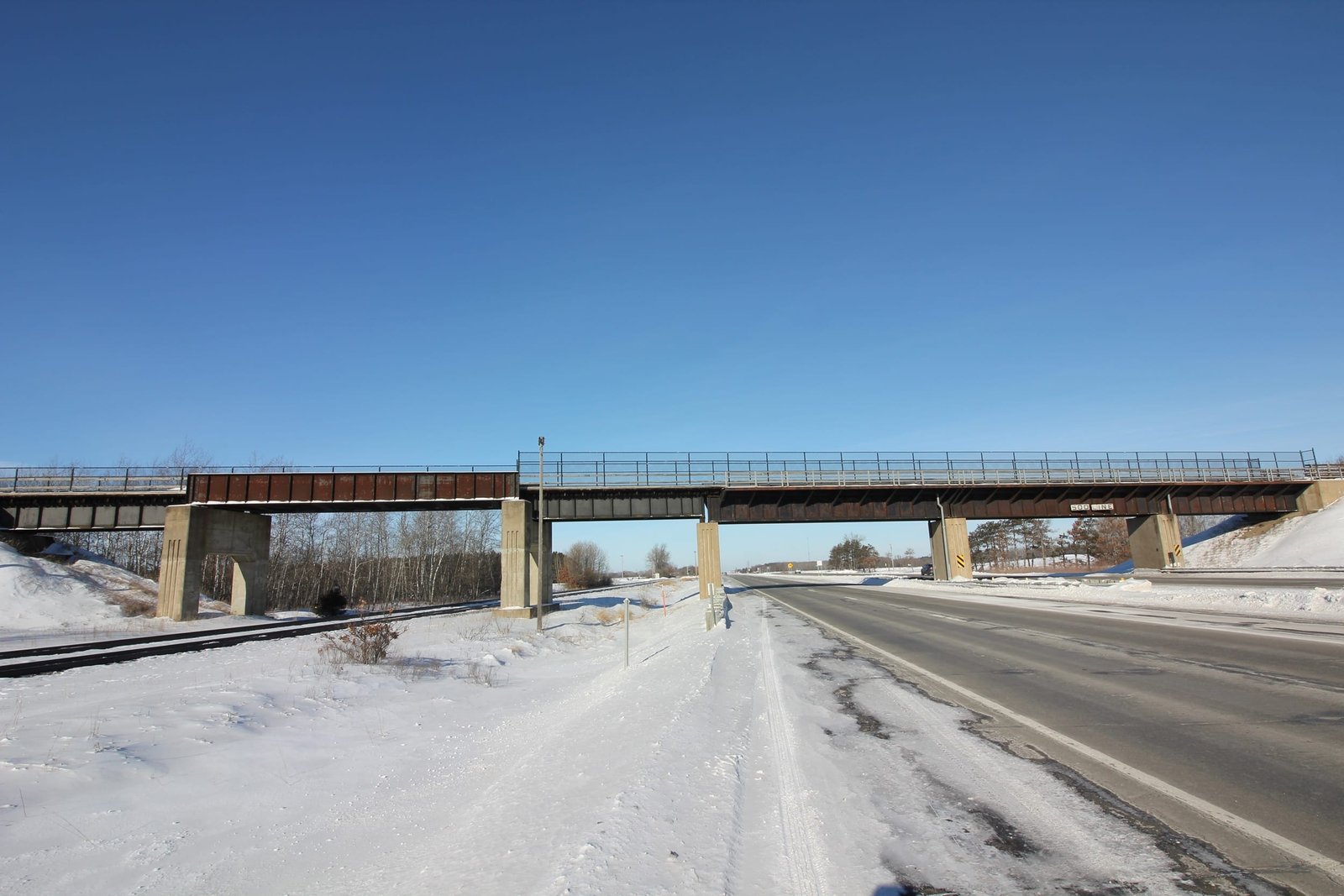
Located west of Royalton, this large through and deck plate girder bridge carries the Soo Line Trail over US Highway 10 and the BNSF Staples Subdivision. Built between 1958 and 1960, the bridge features three ballasted deck plate girder spans across US Highway 10, as well as a through plate girder span approached by an open deck plate girder span on either end. The entire bridge sits on concrete substructures. It appears that the through and deck girder spans over the BNSF were moved here from an unknown location. At this time, it is unknown what the history of those spans is. Overall, the bridge appears to be in good condition, with no major deterioration noted during the field visit. The author has rated the bridge as locally significant, due to the common design and newer age.
Citations
| Build Date | National Bridge Inventory (NBI) |
| Railroad History Citation | ICC Valuation Information, Compiled by Richard S. Steele |