
Click the photo to view the full-size version
| Name | C&NW MN-101 Bridge Minneapolis & St. Louis Railway Bridge #12 |
| Built By | Minneapolis & St. Louis Railway |
| Currently Owned By | Chicago & North Western Railway (Final Owner) |
| Superstructure Contractor | Phoenix Bridge Company of Phoenixville, Pennsylvania |
| Substructure Contractor | Walsh Construction Company of Davenport, Iowa |
| Length | 24 Feet Total |
| Width | 1 Track |
| Height Above Ground | 14 Feet 0 Inches |
| Superstructure Design | Deck Plate Girder |
| Substructure Design | Concrete |
| Date Built | 1902 |
| Date Removed | 1992 |
| Traffic Count | 0 Trains/Day (Bridge is Removed) |
| Current Status | Removed but not replaced |
| Minneapolis & St. Louis Railway Bridge Number | 12 |
| Significance | Local Significance |
| Documentation Date | 2/2/2013 |
In 1871, the Minneapolis & St. Louis Railway began construction of 28 miles of new railroad, extending from Minneapolis, Minnesota to Merriam Junction in Scott County. By 1878, the line would be extended an additional 93 miles to the Minnesota/Iowa border south of Albert Lea, where it would connect with previously constructed lines extending into Iowa. The Minneapolis & St. Louis Railway would be reorganized into the Minneapolis & St. Louis Railroad (M&StL) in 1895. Between 1901 and 1902, the M&StL would realign a significant portion of the route between Hopkins and Chaska, reducing the steep grades on Chaska Hill. The route would become the backbone of the M&StL system, as it would later acquire Iowa Central Railway, and grow into a medium sized system, connecting the Twin Cities to Peoria and Des Moines. The M&StL would later reorganize as the Minneapolis & St. Louis Railway in approximately 1920.
The M&StL was often in financial trouble, and would be purchased by the Chicago & North Western (C&NW) in 1960. The C&NW preferred this segment of track, as it gave a direct connection between the Twin Cities and the mainline in Iowa. When the C&NW purchased the parallel Rock Island line in 1983, this line became redundant. In 1984, the segment between Montgomery, Minnesota and Waseca, Minnesota would be abandoned, and in 1986, the segment from Waseca to Hartland, Minnesota would be sold to the Dakota, Minnesota & Eastern Railroad (DM&E). Further abandonments came in 1991, when the segment between Minneapolis and Chaska was abandoned, and acquired by Hennepin and Carver Counties for future use. The route would be converted to the Minnesota River Bluffs Trail between Chaska and Hopkins, and converted to the Cedar Lake Trail between Hopkins and Minneapolis. In 1995, the C&NW would be purchased by Union Pacific Railroad. A portion of the Kenilworth Cooridor through Minneapolis would later have tracks reinstalled in the late 1990s to serve the Canadian Pacific Railway/Twin Cities & Western Railroad operations into Minneapolis.
In 2007, a small trestle along the Minnesota River would collapse under a freight train serving the United Sugars plant in Chaska. As a result, the segment from Merriam Junction to Chaska would be abandoned in 2008. DM&E also abandoned the Hartland to Waseca segment the same year. Carver and Scott Counties would reach an agreement with Union Pacific for the Chaska to Montgomery segment in 2011, and the bridge across the Minnesota River at Carver would be removed that year. The segment between Chaska and Carver would be converted to a trail in 2012, and future plans indicate a desire to extend the trail to Merriam Junction. Construction began on the Southwest Light Rail (Metro Green Line Extension) in 2018, which will utilize the former M&StL grade between Shady Oak Road in Hopkins and Minneapolis. Union Pacific continues to operate the Merriam Junction to Montgomery segment as the Montgomery Industrial Lead.
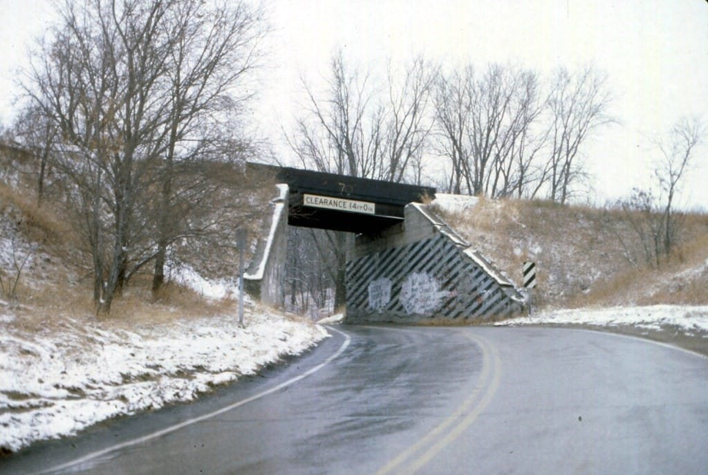
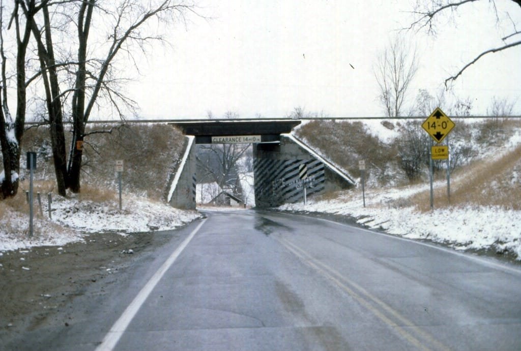
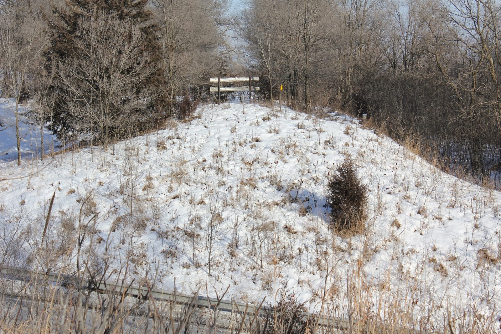
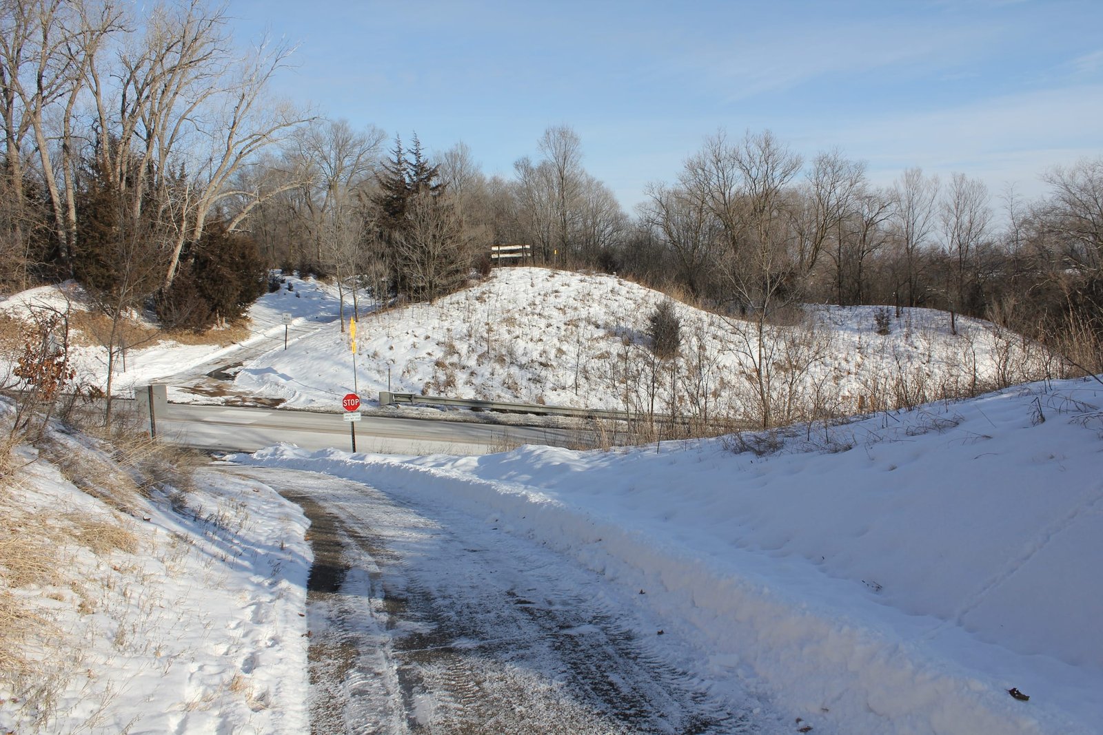
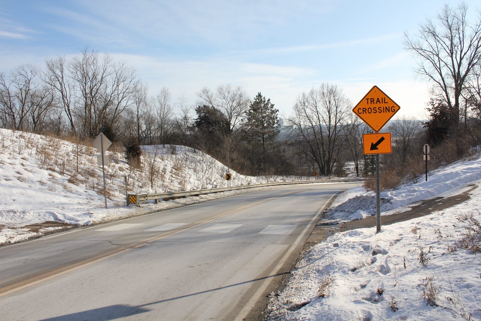
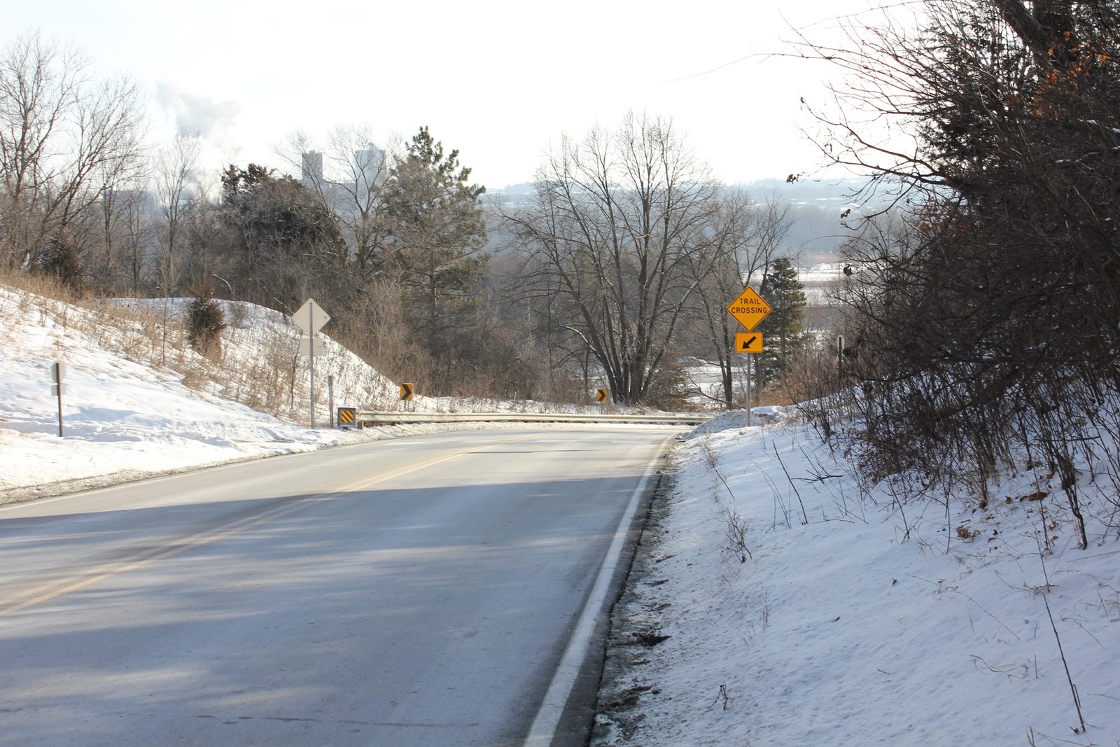
Located north of County Road 61 (former US-212), this deck plate girder bridge once crossed Minnesota Highway 101. Historically, MN-101 in Carver County has been a hilly, curvy road. Originally known as Shakopee Highway, this road was an important connection between eastern Carver County and Shakopee. It is believed that the road was previously crossed by a timber pile trestle bridge, which was on a similar alignment to the steel and concrete bridge. Between 1902 and 1903, the M&StL undertook a large project to reduce grades and realign the railroad between Hopkins and Chaska. The original route was steep and used large timber trestles to cross ravines as it climbed out of the Minnesota River valley, limiting traffic on the line. A contract was awarded to the Walsh Construction Company for the reconstruction of the line, which included heavy grading and large concrete structures.
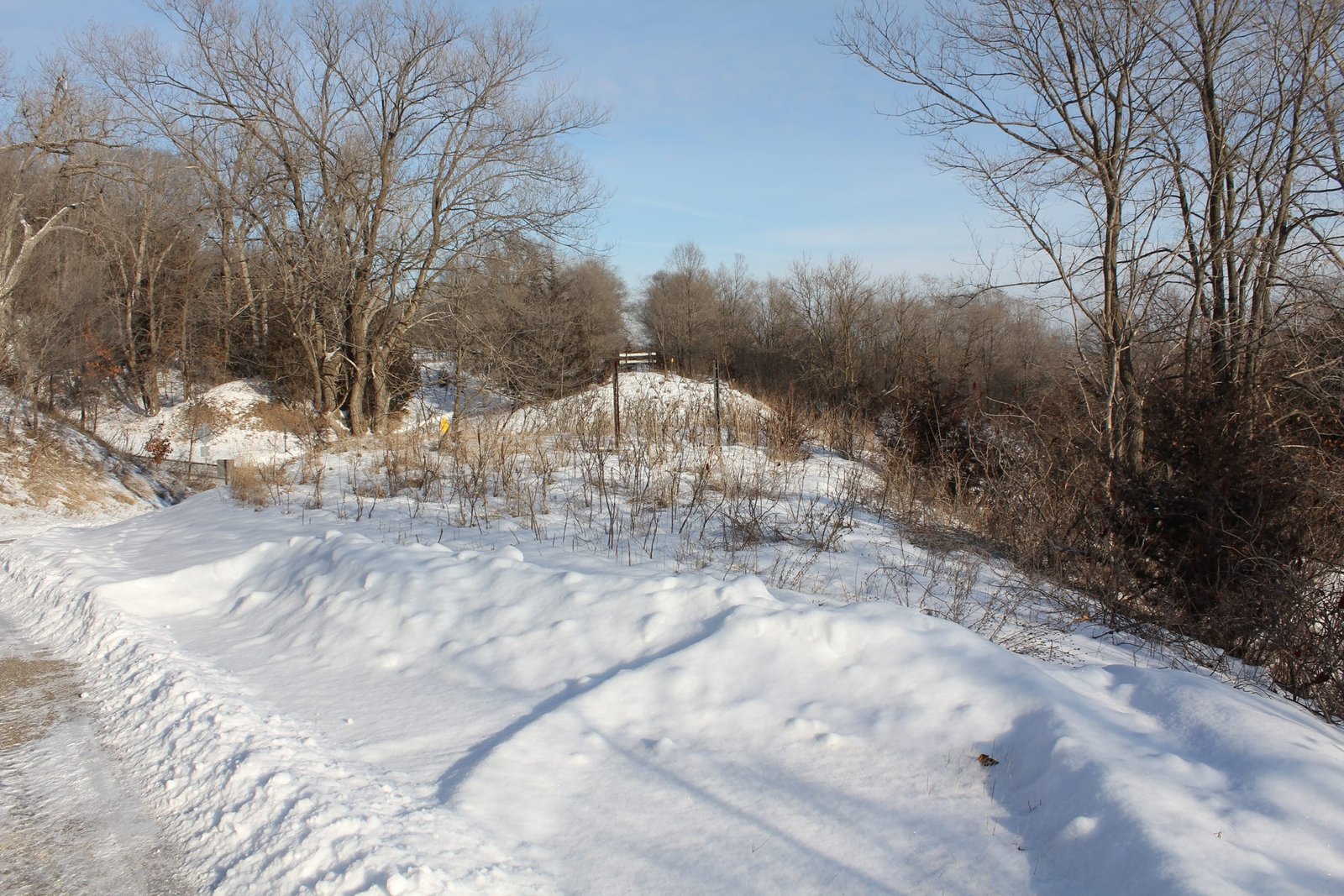
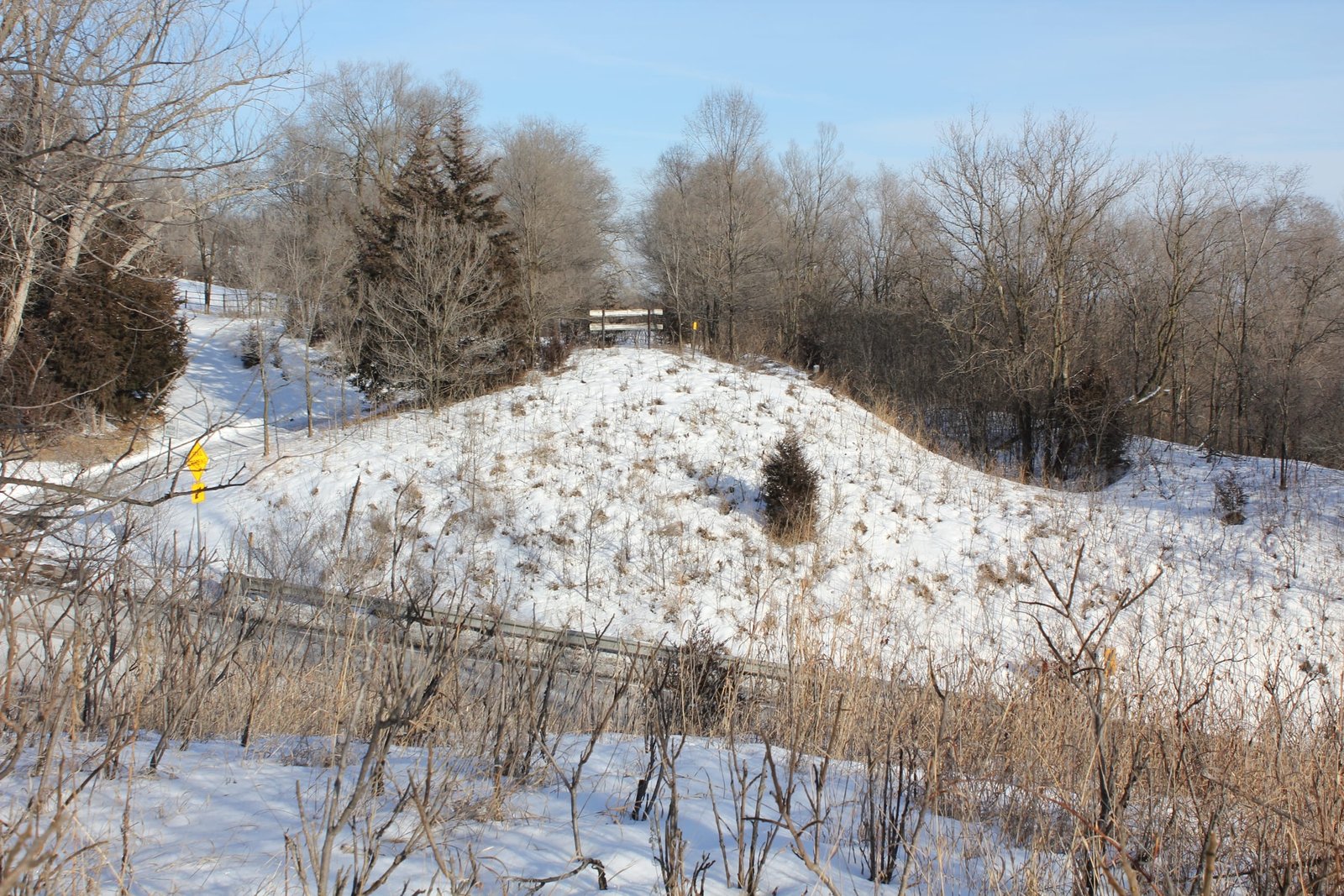
As part of the realignment work, MN-101 was slightly realigned to improve curves and grades. The bridge across MN-101 consisted of a 24-foot deck plate girder span, set onto concrete abutments. The girder used a design commonly used during this era, including shallow beams and a ballast deck. Phoenix Bridge Company fabricated the superstructure, and it is believed that Walsh Construction Company completed the concrete work and erected the superstructure. The bridge was located immediately east of the large Bluff Creek arch, which was constructed at the same time. After the railroad was abandoned in 1991, the bridge was removed in 1992 as it was too narrow and too low for modern roadway standards. In 2021, County Road 101 (formerly MN-101) was reconstructed through this location, leaving no trace of the narrow deck plate girder bridge that once stood here. Today, a large prefabricated pedestrian bridge carries the Minnesota River Bluffs Trail across the roadway. At the time of removal, the bridge appeared to be in fair condition, but was not suitable for crossing a heavily used road. The author has ranked this bridge as being locally significant, due to the common design.
Citations
| Builder and build date | Phoenix Bridge Company order book; part of Phoenix Steel Company records located at the Hagley Museum |
| Builder (substructure) | Improvement Bulletin; November 28, 1903 |
| Railroad History Citation | ICC Valuation Information, Compiled by Richard S. Steele |