
Click the photo to view the full-size version
| Name | Chicago & North Western Railway Culvert #H88.69 Chicago Great Western Railway Bridge #169.69 |
| Built By | Chicago Great Western Railway |
| Currently Owned By | Wright County |
| Superstructure Contractor | Unknown |
| Length | 10 Feet Total |
| Width | 1 Track (30 Feet) |
| Height Above Ground | 5 Feet (Estimated) |
| Superstructure Design | Stone Arch Culvert |
| Substructure Design | Stone Masonry |
| Date Built | c. 1900 |
| Traffic Count | 0 Trains/Day (Bridge is Open to Pedestrian Traffic) |
| Current Status | Open to Pedestrian Traffic |
| Chicago Great Western Railway Bridge Number | 169.69 |
| Union Pacific Railroad Bridge Number | 29.31 |
| Significance | Local Significance |
| Documentation Date | 3/6/2020 |
In 1886, the Mason City & Fort Dodge Railroad (MC&FD) constructed 73 miles of new railroad, extending from Mason City, Iowa to Fort Dodge, Iowa. In 1901, the MC&FD was leased by the Chicago Great Western Railway (CGW). Between 1902 and 1903, the MC&FD constructed 133 miles of new railroad, extending from Fort Dodge, Iowa to Council Bluffs, Iowa. The CGW would be reorganized as the Chicago Great Western Railroad in 1909, and maintained a lease of the MC&FD property. The CGW had acquired and constructed a modest railroad network throughout Illinois, Iowa, Minnesota and Missouri; connecting major cities in these states. The CGW was one of the smaller railroads in the area, and was late to develop lines. As a result, the railroad never saw the fortunes of other railroads in the area. This line served as a principal mainline for the CGW, serving agricultural industries and providing a connection to terminals at Omaha, Nebraska. In the early 20th Century, the CGW was often surviving on razor-thin profit margins. In 1940, the CGW entered bankruptcy, and was again reorganized as the Chicago Great Western Railway. At this time, the MC&FD was formally merged into the CGW. After the bankruptcy, the CGW became an innovative railroad, pioneering intermodal service and becoming one of the first railroads to completely switch to diesel locomotives. A capital improvement program was launched in 1949, which sought to rebuild and rehabilitate deteriorated infrastructure.
In 1953, the Chicago, Rock Island & Pacific Railroad (Rock Island) began using a segment between McClelland, Iowa and Council Bluffs. In 1968, the CGW was purchased by the Chicago & North Western Railway (C&NW). The C&NW already owned a better constructed route serving Council Bluffs, and much of this line became excess for the C&NW. In 1971, a section of the line between Harlan and Council Bluffs was abandoned, and the McClelland to Council Bluffs segment sold to the Rock Island. An additional segment between Somers and Carroll was abandoned in 1977, followed by a section between Manning and Harlan in 1981 and a section between Carroll and Manning in 1983. After the Rock Island went bankrupt in 1980, the McClelland to Council Bluffs segment became part of the Iowa Interstate Railroad (IAIS). In 1995, the C&NW was purchased by Union Pacific Railroad (UP). UP abandoned a section of the line between Thornton and Belmond in 2000, followed by a section between Mason City and Thornton in 2007 and a section between Roelyn and Somers in 2008. Today, UP operates the Fort Dodge Subdivision between Belmond and Roelyn and IAIS operates a short segment of the Council Bluffs Subdivision between McClelland and Council Blufffs. The segment between Mason City and Belmond was acquired for trail use, and portions of the right-of-way have been reused as part of the Prairie Land Trail. The remainder of the line has largely reverted to adjacent landowners, and has been converted to farm fields.
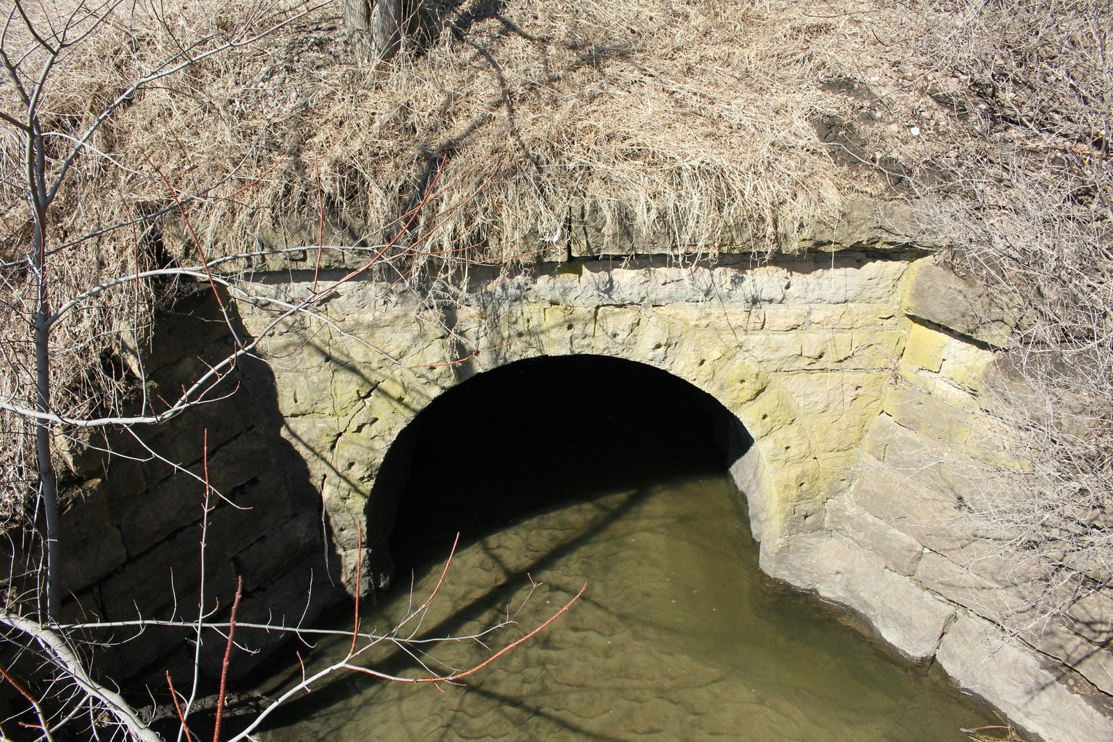
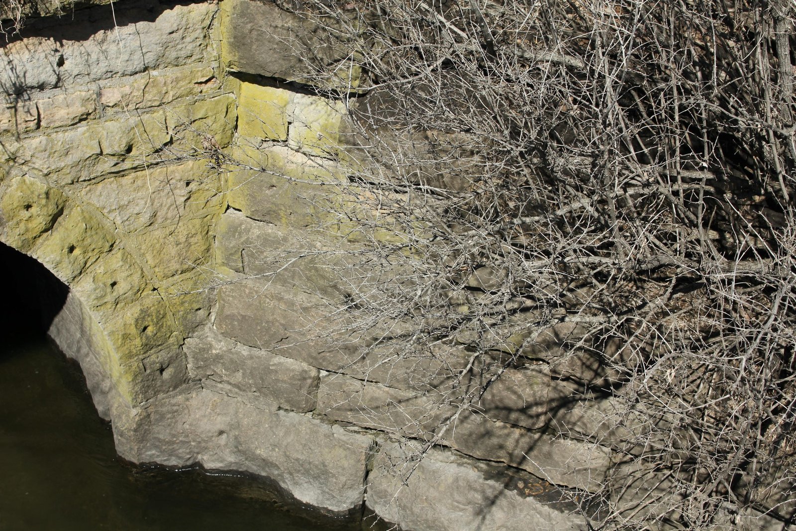
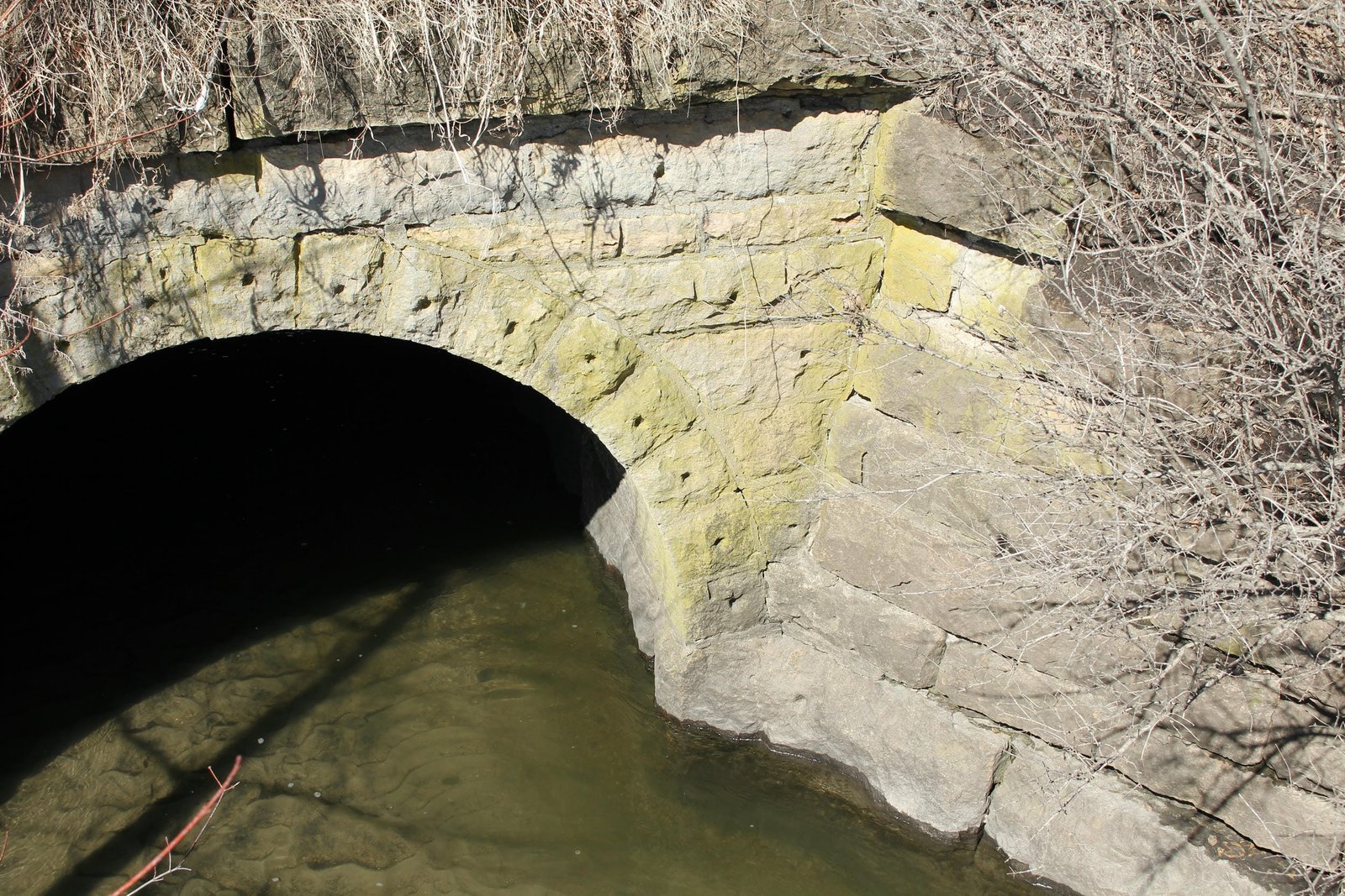
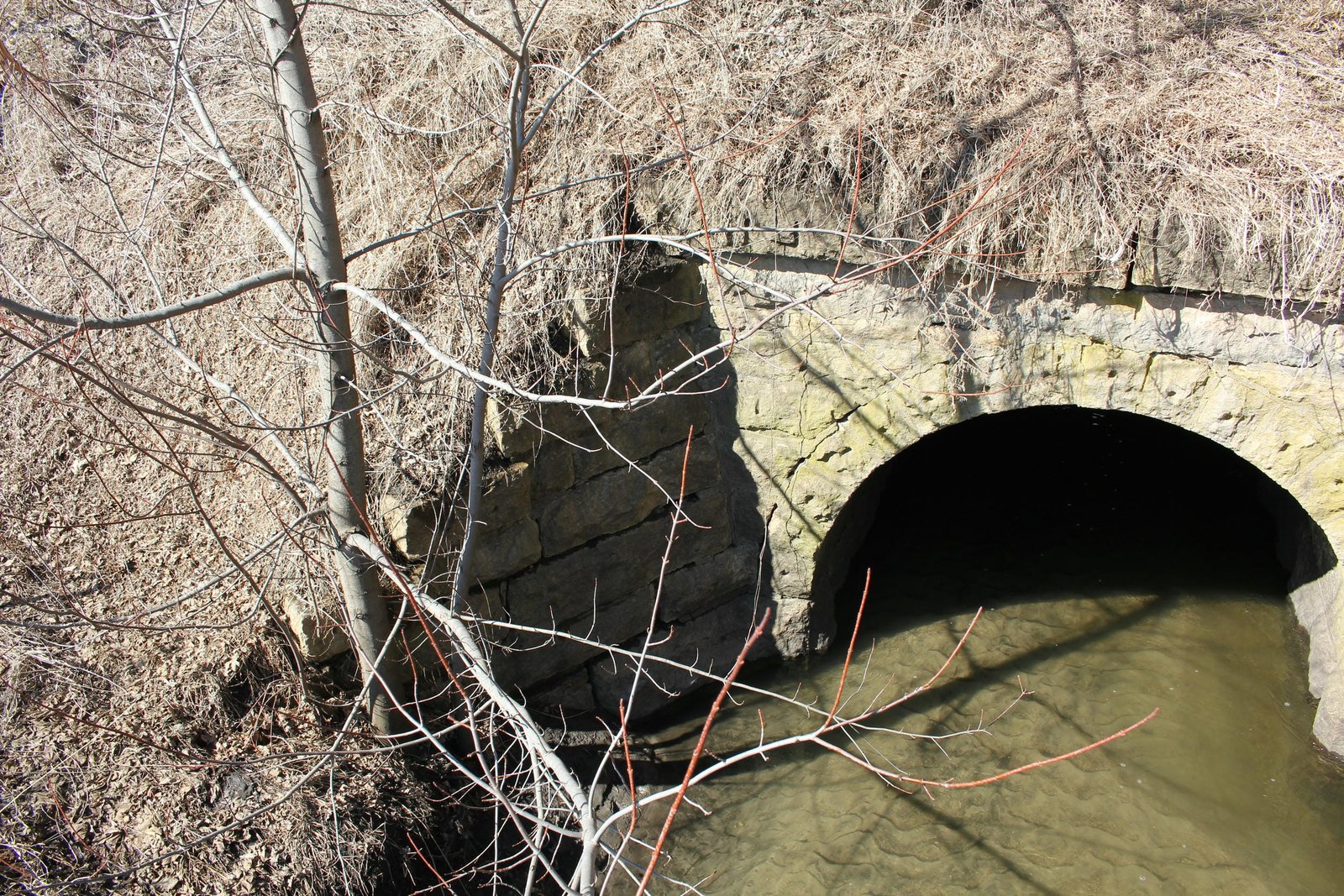
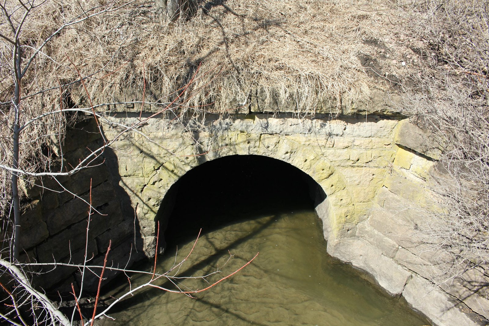
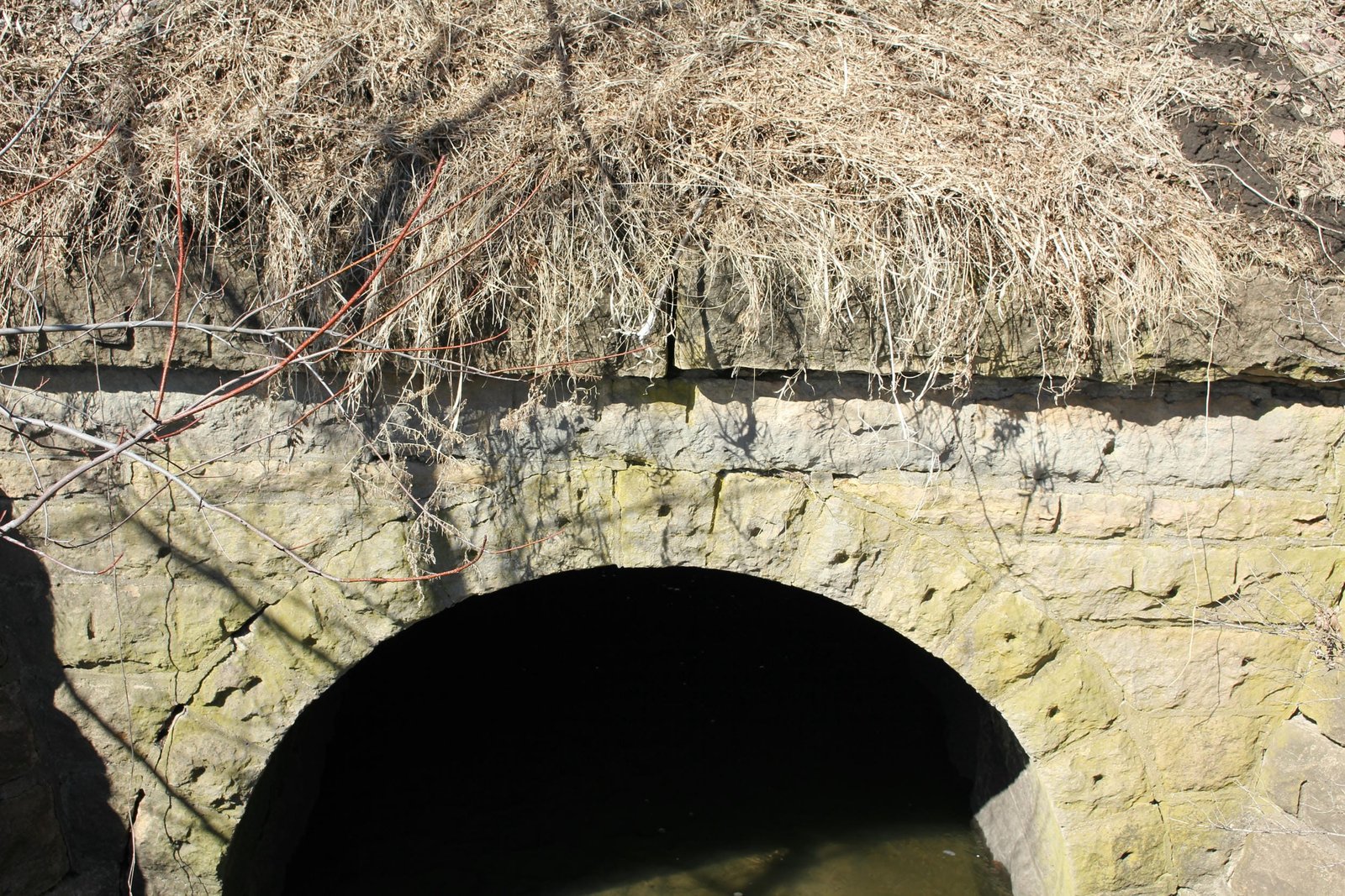
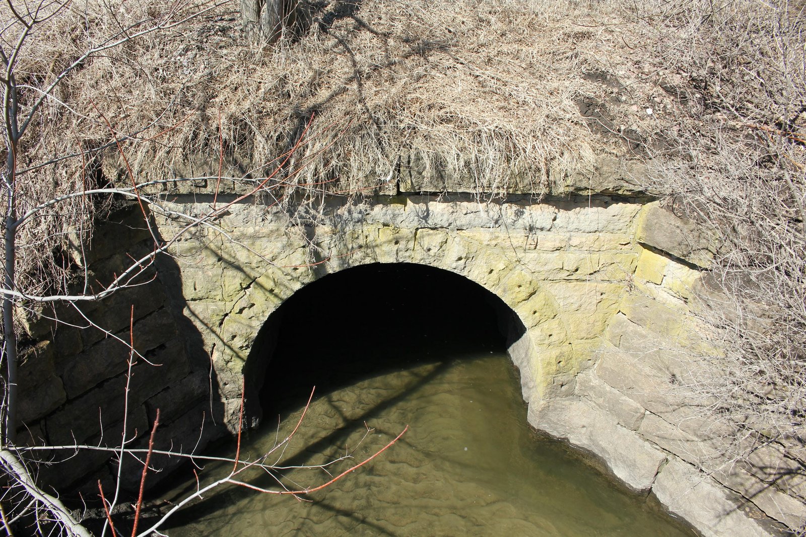
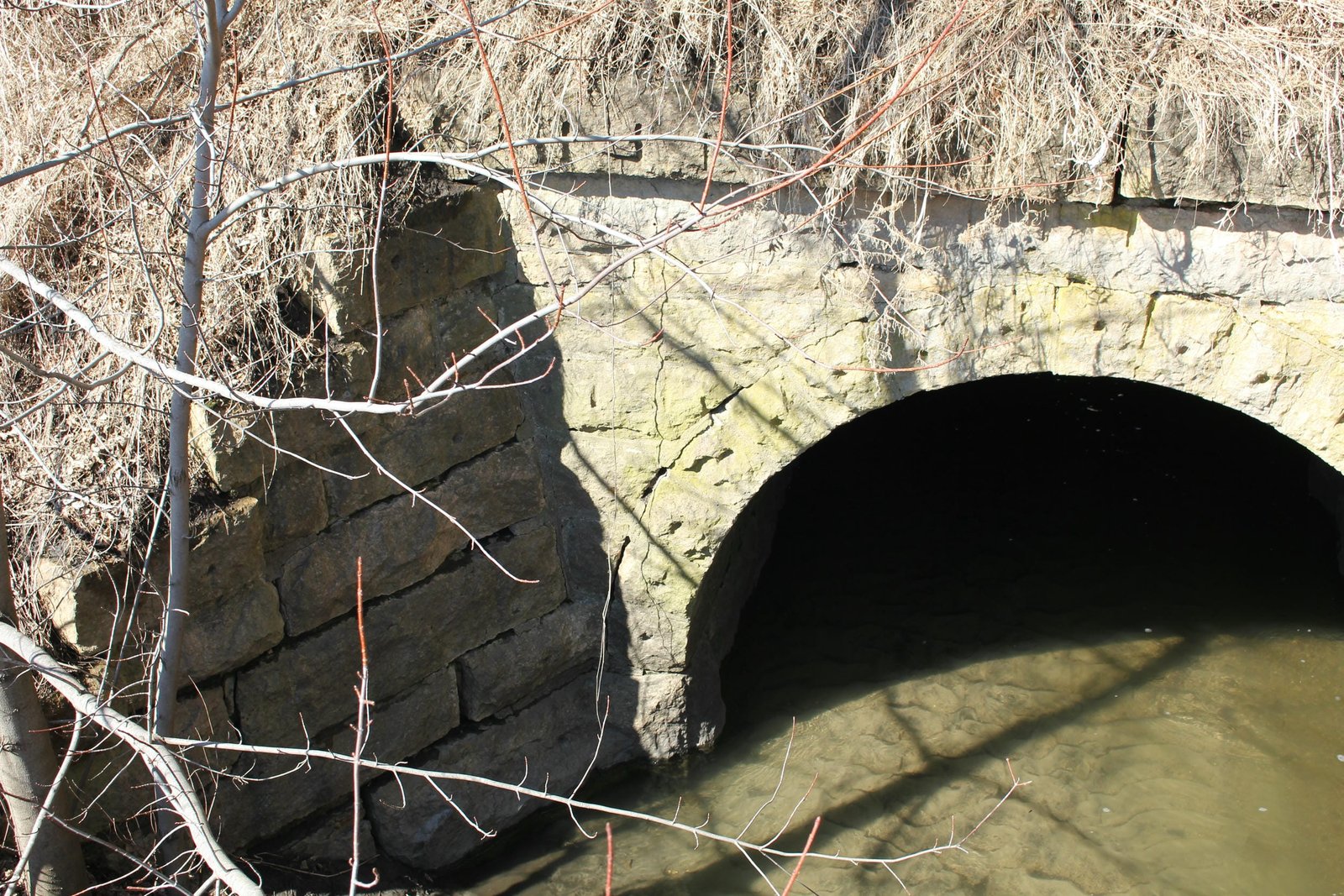
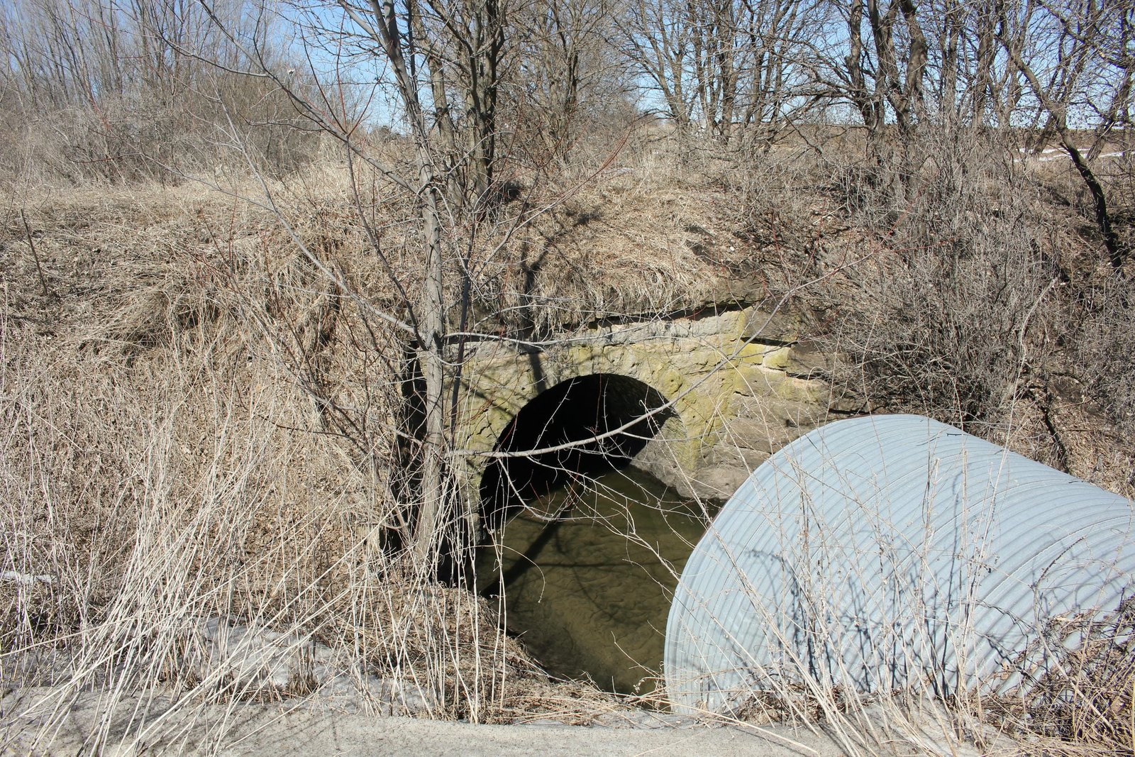
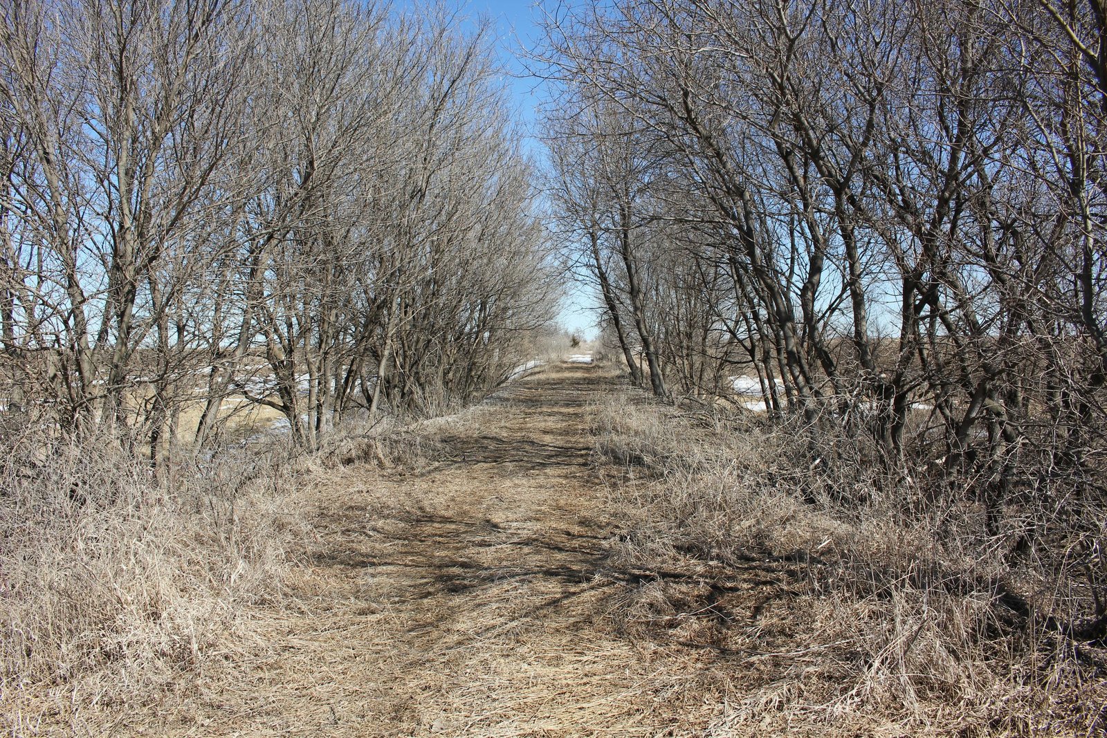
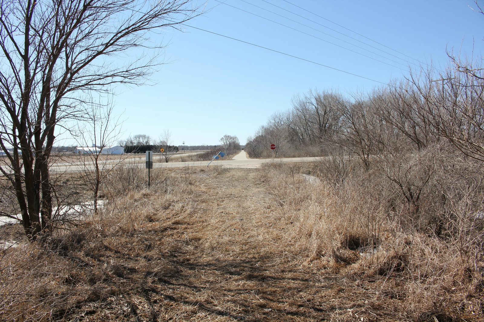
Located along County Road C20 north of Belmond, this stone arch culvert carries a former Chicago Great Western Railway line over an unnamed creek. The first bridge at this location likely consisted of a timber pile bridge, constructed when the line was first built. In the late 1890s and early 1900s, the MC&FD and CGW invested significant capital into their lines, replacing timber bridges with steel, stone and concrete structures. The present culvert was constructed in approximately 1900. Currently, the culvert consists of a 10-foot by 8-foot stone arch culvert, set onto stone substructures and constructed at a width of 30 feet. The culvert follows a standard design, with a semicircular arch and stepped wing walls extending diagonally from the structure. Stone for the culvert consists of a yellow limestone, likely quarried at Mankato, Minnesota. An unknown contractor constructed the culvert. Stone arches were popular for railroad use in the 19th Century, as they were durable and easy to construct. The CGW continued using stone arches into the early years of the 20th Century, as the railroad had access to high quality limestone at the Widell Quarry in Mankato. Since the initial construction, the culvert has seen no significant alterations. Today, the culvert is used by the Prairie Land Trail, which will eventually consist of a paved trail between Mason City and Belmond. Currently, the trail is unimproved and is grass surfaced. Overall, the culvert appears to be in fair to good condition, with minor deterioration noted to the stone. The author has ranked this culvert as being locally significant, due to the common design.
Citations
| Railroad History Citation | ICC Valuation Information, Compiled by Richard S. Steele |