


Click the photo to view the full-size version
| Name | UP Bridge #50.92 Chicago & North Western Railway Bridge #355 |
| Built By | Chicago, St. Paul, Minneapolis & Omaha Railway |
| Currently Owned By | Union Pacific Railroad |
| Superstructure Contractor | Unknown |
| Length | 15 Feet Total |
| Width | 2 Tracks, 1 In Use (57 Feet) |
| Height Above Ground | 10 Feet (Estimated) |
| Superstructure Design | Stone Arch |
| Substructure Design | Stone Masonry |
| Date Built | 1891, Widened 1912 |
| Traffic Count | 5 Trains/Day (Estimated) |
| Current Status | In Use |
| Chicago & North Western Railway Bridge Number | 355 |
| Union Pacific Railroad Bridge Number | 50.92 |
| Significance | Local Significance |
| Documentation Date | 3/18/2019 |
In 1867, the West Wisconsin Railway (WW) constructed 10 miles of new railroad, extending from Tomah to Warrens, Wisconsin. The following year, 21 additional miles would be completed to Black River Falls, Wisconsin; 34 additional miles were completed to Augusta, Wisconsin in 1869; 46 additional miles would be constructed to Eau Claire, Wisconsin in 1870, and 44 miles between Eau Claire and Hudson, Wisconsin completed in 1871. In 1871, the St. Paul, Stillwater & Taylors Falls Railroad (StPS&T) completed 22 miles from St. Paul, Minnesota to Hudson in 1871. During 1872, the WW completed 32 miles of additional railroad between Elroy and Warrens, Wisconsin; and the previous alignment between Tomah and Warrens would be abandoned. The WW would be acquired by the Chicago, St. Paul & Minneapolis Railway in 1878, which was acquired by the Chicago, St. Paul, Minneapolis & Omaha Railway (Omaha Road) in 1880. The StPS&T would be acquired by the St. Paul & Sioux City Railroad (StP&SC) in 1880, and the StP&SC would be purchased by the Omaha Road in 1881. By acquiring this route, the Omaha Road had completed a mainline extending from Elroy, Wisconsin through St. Paul, Minnesota to Sioux City, Iowa.
The first significant improvement to this line was a new bridge and alignment at Hudson, Wisconsin; completed in 1881. At the same time, the Omaha Road was working to replace major bridges with new iron and stone structures. In 1883, the Omaha Road would come under control of the Chicago & North Western Railway (C&NW). The C&NW operated numerous routes throughout the Upper Midwest, and the Omaha Road served as a principal component of the system. As traffic increased on this route, significant improvements would be made. Realignments would be completed in 1885 near Augusta and Merrillan; between Millston and Warrens in 1886; between Baldwin and Hersey and Altoona and Fall Creek in 1891; between Hudson and Roberts in 1898, and between Hersey and Knapp and west of Millston in 1899. Further realignments would occur in 1901, when a new cutoff around Black River Falls was completed. In 1903, more improvements were made between Roberts and Hammond; around Woodville; west of Menomonie; west of Elk Mound and near Truax. A second track was constructed between Augusta and Altoona in 1907. In 1911 ans 1912, the remaining second track would be constructed from Wyeville to Menomonie, including realignments near Eau Claire and Menomonie. The second track would be completed to St. Paul in 1913. In 1915, the original alignment in Black River Falls would be abandoned.In 1957, the C&NW leased the Omaha Road. Between 1957 and 1962, most of the second track would be removed. In 1971, the Sheppard to Black River Falls spur would be abandoned. By 1972, the Omaha Road was fully absorbed into the C&NW. In 1986, the Levis to Black River Falls spur would be abandoned. The Camp Douglas to Elroy segment would be abandoned in 1986, and purchased by Juneau County in 1972. The Omaha Trail would open on the former railroad in 1992. In 1992, the original alignment in Eau Claire would be abandoned. In 1995, the C&NW would be purchased by Union Pacific Railroad. Today, UP operates the Altoona Subdivision from St. Paul to Altoona; the Wyeville Subdivision from Altoona to Wyeville; and the Camp Douglas Industrial Lead from Wyeville to Camp Douglas.
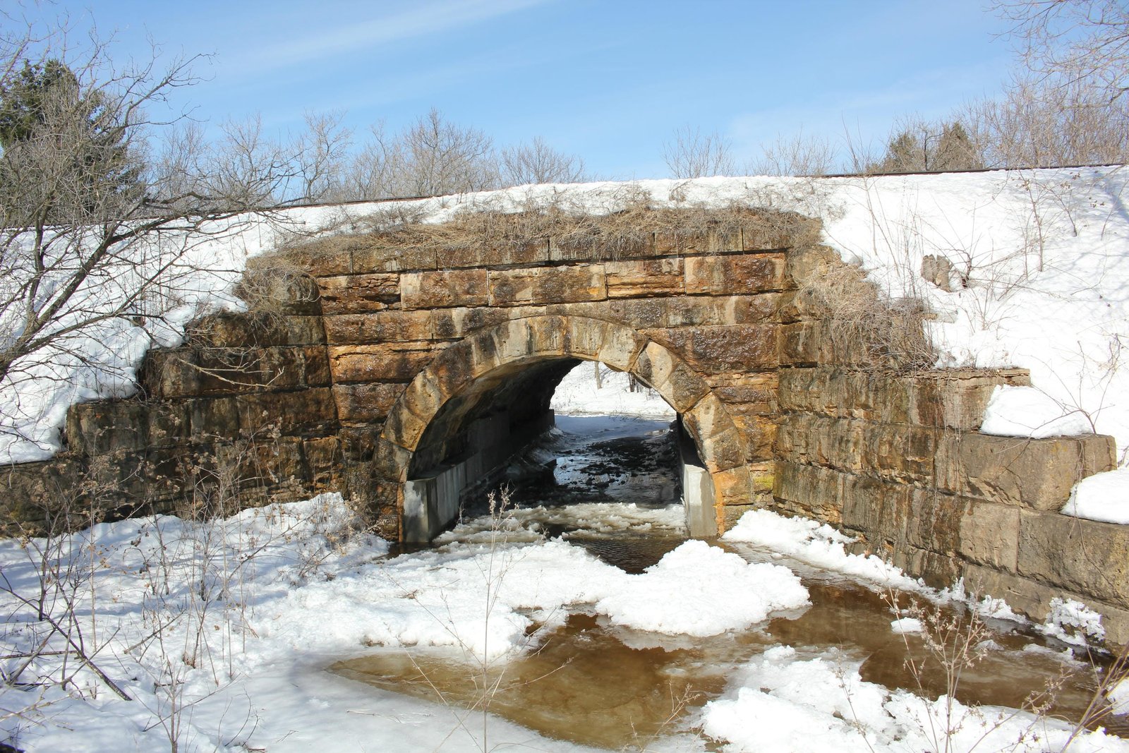
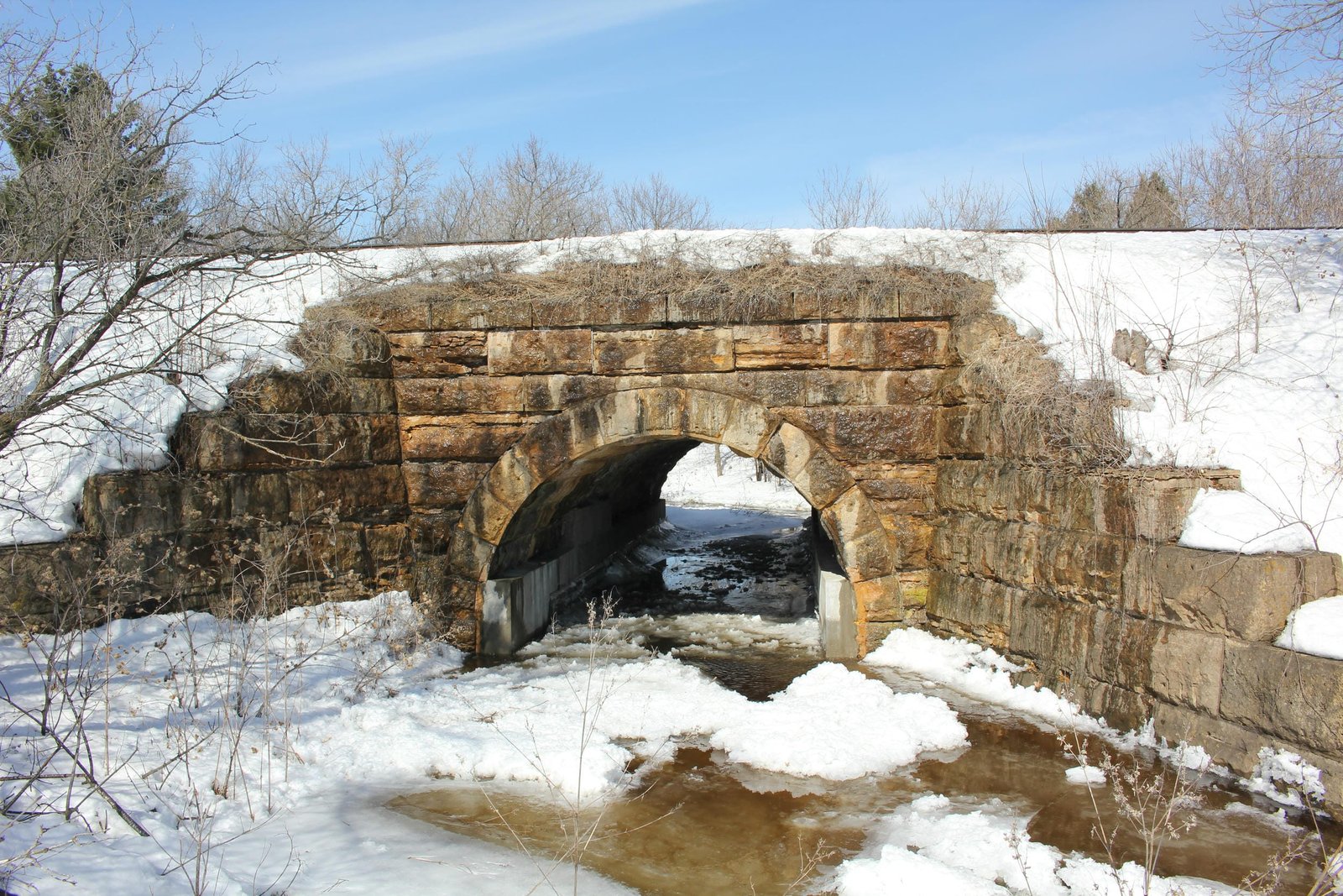
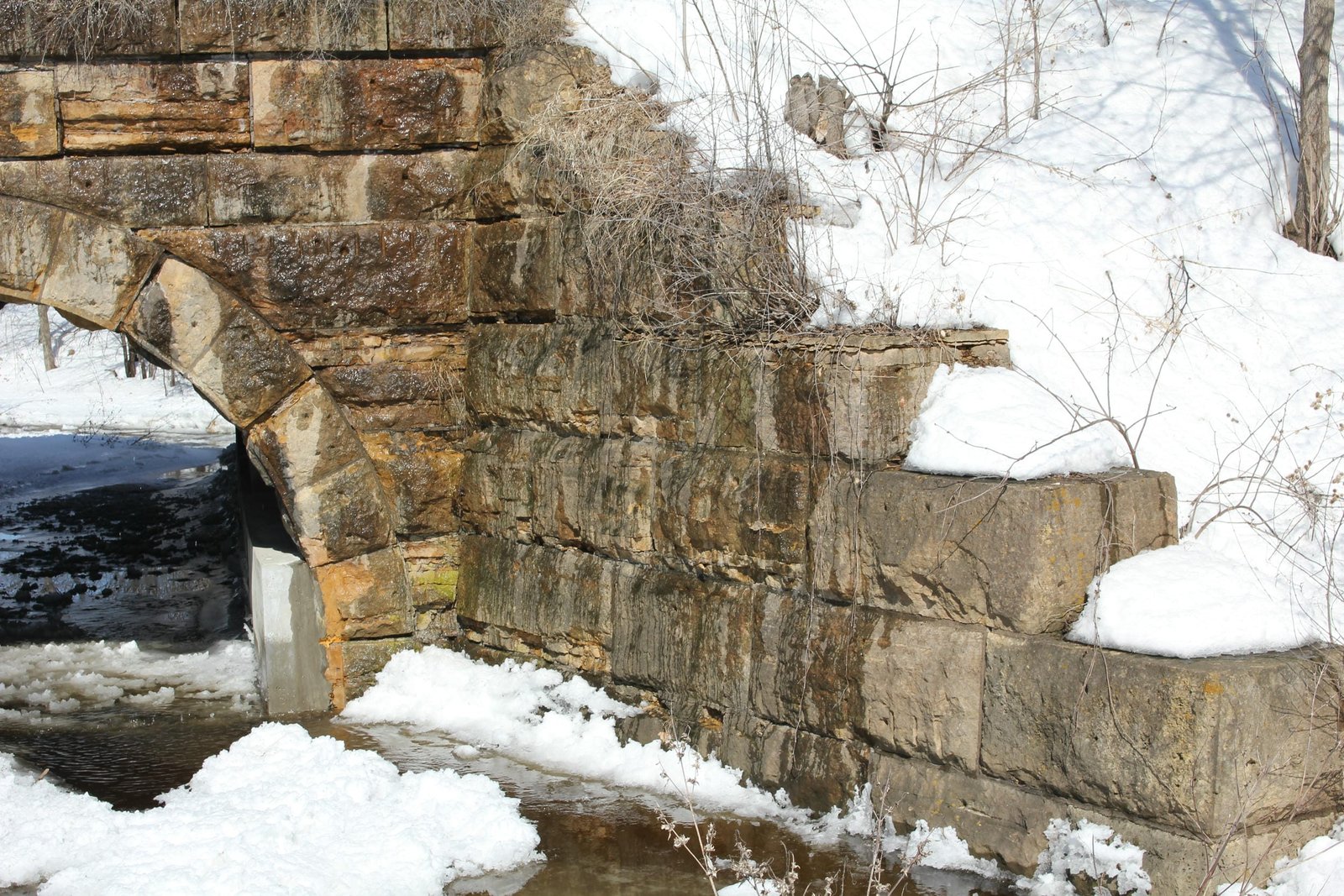
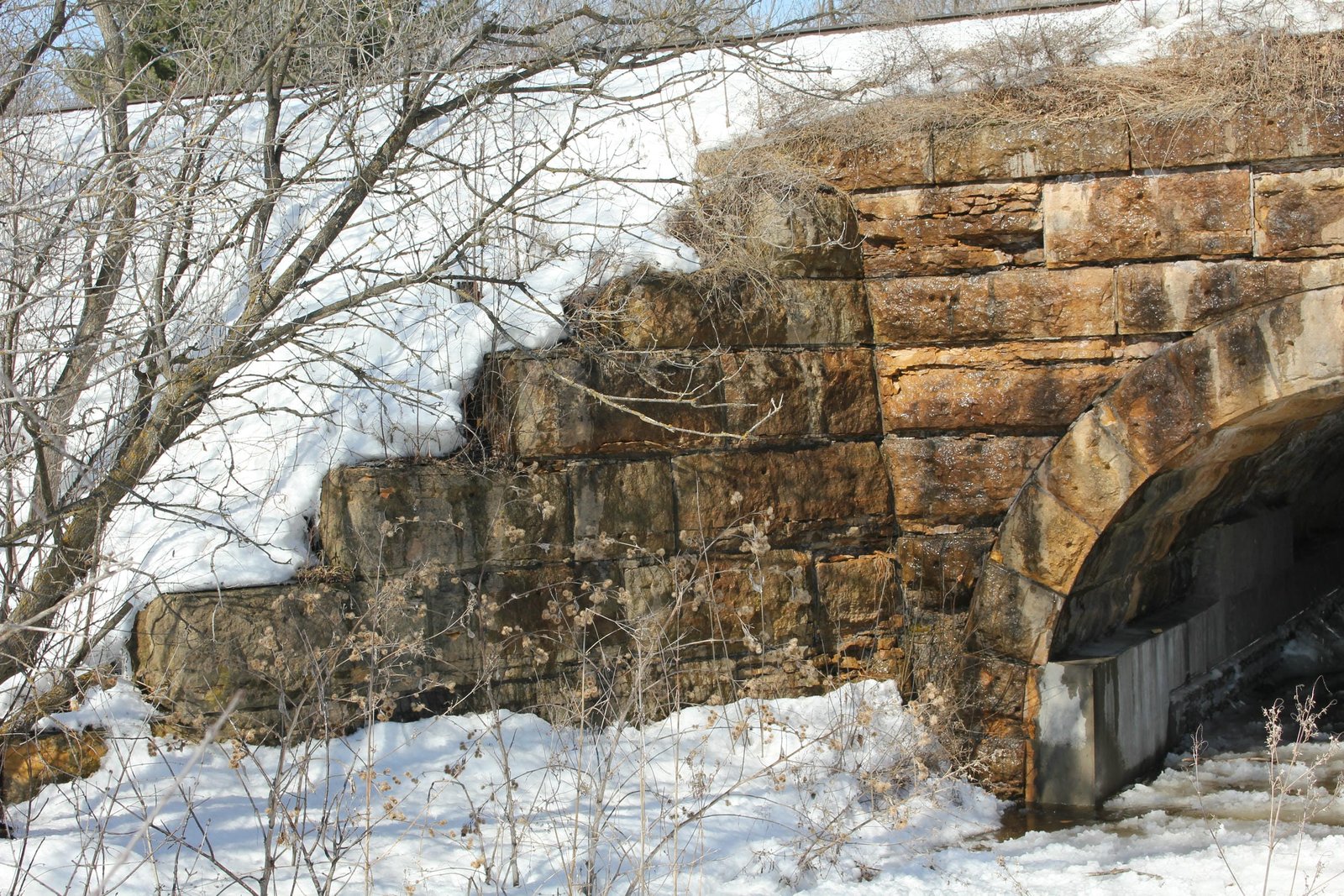
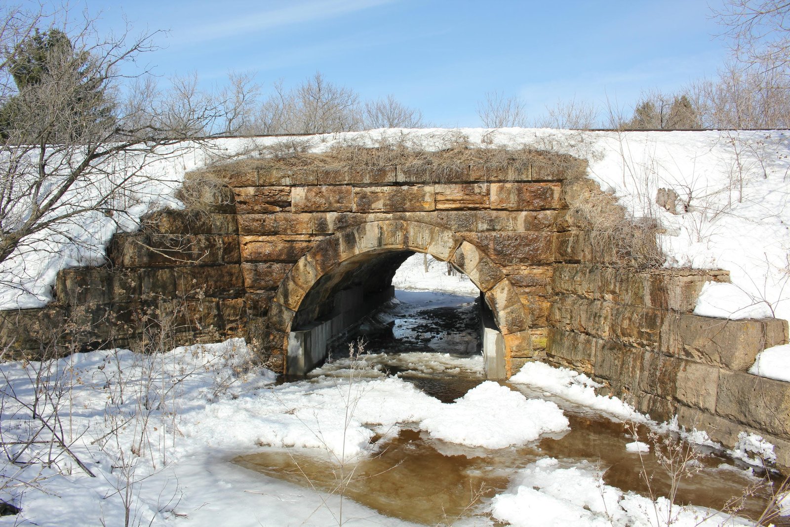
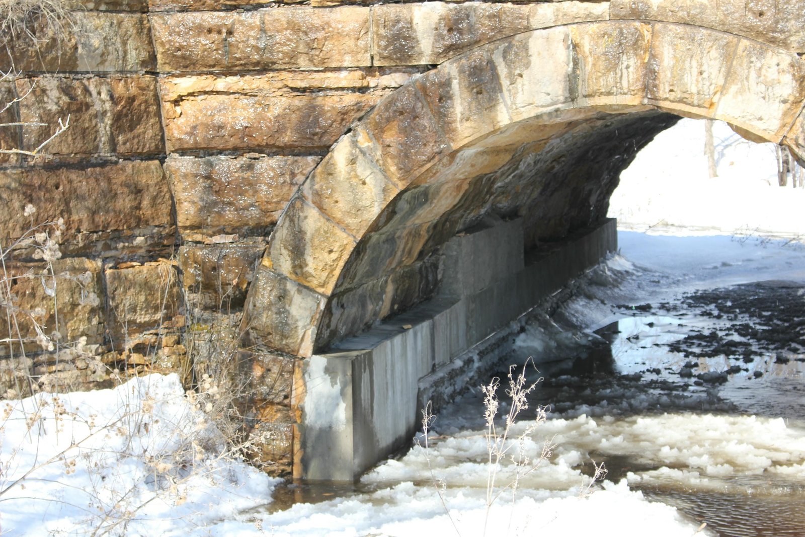
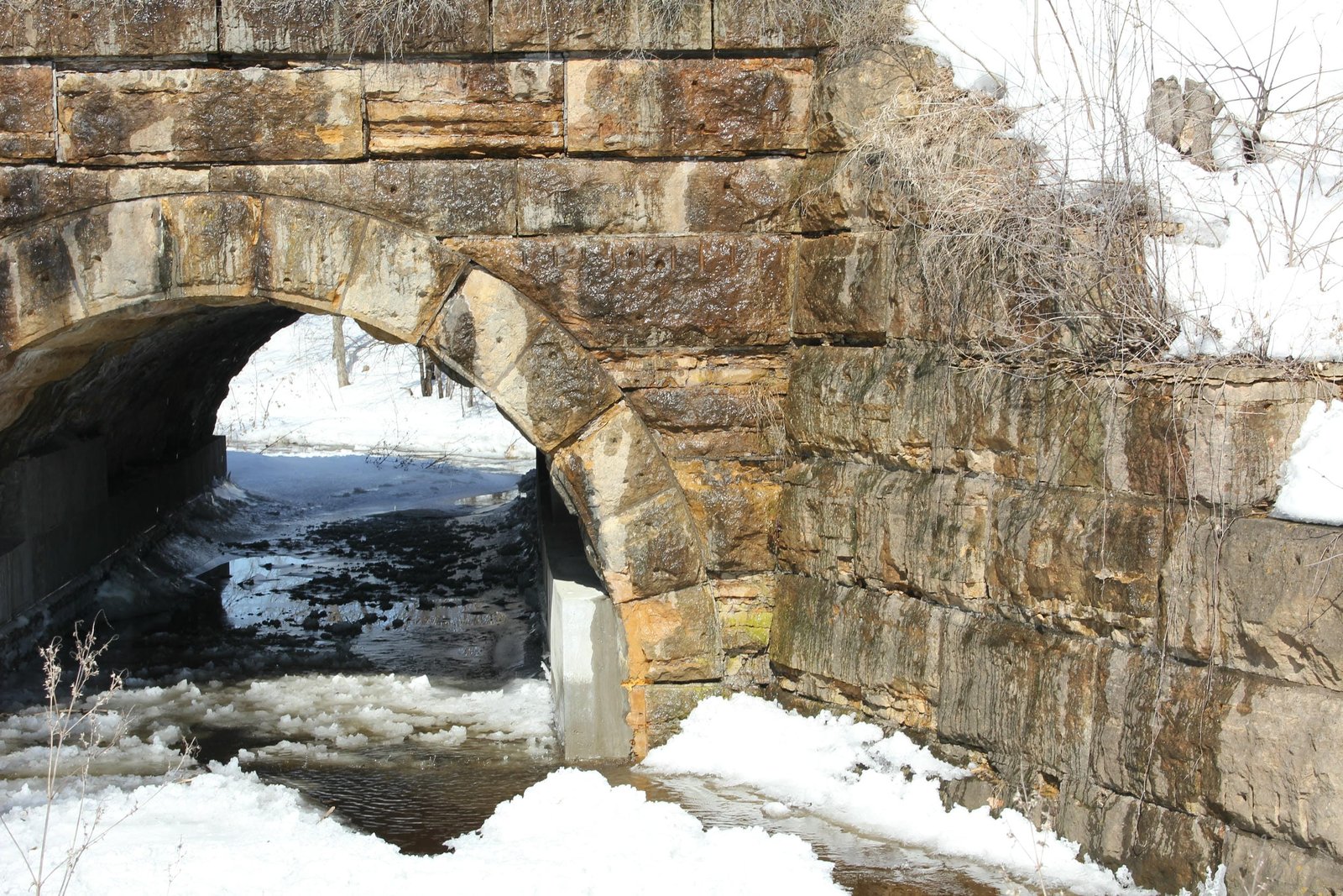
Located near US Highway 12 in Wilson, this stone arch bridge carries the former Chicago, St. Paul, Minneapolis & Omaha Railway mainline over an unnamed tributary of Wilson Creek. Originally, this line was located approximately one mile north of this location. The first bridge across this creek likely consisted of a timber pile trestle, located north of present day Dahlberg Street. In 1891, the line would be realigned to improve grades and curves. At this time, a new stone arch bridge would be constructed at this location. Between 1912 and 1913, a second track was constructed along this line, and the bridge extended on the south, giving this structure its current configuration. Currently, the bridge consists of a 15-foot stone arch, constructed at a width of 57 feet. Typical of Omaha Road stone arches, the bridge uses a standard semicircular shape and wing walls which extend diagonally from the structure. The bridge is constructed using limestone quarried at Mankato, Minnesota, and was built by unknown contractors. Extending a structure in this manner was a common technique for the Omaha Road, as it was cheaper than constructing a new structure. Stone arches were commonly used by railroads, as they were durable, cost effective and easy to construct. Overall, the bridge appears to be in fair to good condition, with some deterioration noted to the stone. Concrete repairs were made to failing stone in approximately 2018. The author has ranked this bridge as being locally significant, due to the common design.
Citations
| Builder and build dates | Chicago, St. Paul, Minneapolis & Omaha Railway Valuation Engineering Field Notes at the National Archives |
| Railroad History Citation | ICC Valuation Information, Compiled by Richard S. Steele |